LAZAROW WORLD HIKE-ABOUT

New Zealand: Tongariro Alpine Crossing: Ngauruhoe Volcano ("Mt. Doom"), a perfect sunrise.

'LAZAROW WORLD HIKE-ABOUT: WHAT IN THE WORLD IS HIKE-ABOUT?'

Hike-about is an adventure that commenced June 2010. After storing our household movables, ridding ourselves of a house but retaining our 'home' together, we set off with the purpose of hiking in different parts of the world, not forgetting the home country, the USA.

Our primary focus is hiking to mountain peaks but any challenging hike will do just fine. Extended stays enable us to enjoy and experience living in various places amongst differing cultures. Hike-about has evolved into a way of life. It's also a process of discovery, both the world and ourselves.

We work and live 'on the road' but return to the city in which our grandchildren reside, every couple of months. This provides us the wonderful opportunity to be with them as well as a child or two, even three and of course, friends.

By the end of 2023, the blog contained over 1,560 hikes (less than that actually undertaken), each a set of pictures with stories and anecdotes from the trails. An index to the right allows the viewer to identify earlier experiences.

Finally, we are often asked about the journey's end.
O
ur reply, as accurate as we can state, is: "When we are either forced to cease through health issues or the enjoyment level no longer reaches our aspirations, we will hang up the boots."

"A Life Experience As No Other: Dare to Seize the Day Together", published by Fulton Books, depicts our life on the road and mountains until the beginning of 2017. It has developed 'exponentially' since then.

Jenni and Jeffrey Lazarow

Whereas we continue to update the blog regularly, we circulate email notifications infrequently.

Tuesday, August 29, 2023

Cover Supplement (previous): 7-Rila Lakes, one of our finest days in the mountains.

Jen sits on a low peak above the lake, in an isolated position but not far from the many visitors to the park.

We will develop a full blog later. However, on a day that should have been less than ideal because of high winds, tough climbs and tired feet, we probably reached, besides the peak of Haramiyata, a high point in Hike-About. Once we had accepted the wind would be a hindrance and danger, the journey a little uncertain, the possibility of rain looming, the sluggish feelings we both had at the outset, the day turned on the figurative dime and resulted in triumph, satisfaction and a feeling for two insignificant souls of being at one with the world...(temporary, of course).

In the 'former cover' picture above, Jen sits close to a peak (above rear lake) viewed from Haramiyata Peak (Black Peak) at 8,169 feet, across the way on another day. (3 of 7 Rila Lakes on display.)
A view of Haramiyata Peak after returning from the top. Spectacular hiking experience is an understatement.
Standing alongside one of the 7 lakes prior to attempting to reach the peak, in the background.
Jen shows her mettle as she climbs steeply above the lake also shown in the picture above. The hut is in view as well.
Heading toward the peak. While we had to deal with dangerous, gusting winds throughout the period of the climb and return, the wind vanished just before we completed the day's activities. Timing?

Triumph...well at least 'something' in the family made it. Once a person understands that in Bulgarian an "X" is an "H", an "a" is an "a", a "p" is an "r", a "backward N" is really a "y", etc., it's obvious that this is Haramiyata Peak. Sometimes, we English speakers can be awfully dumb.
Jen triumphs again on the peak across the way from Haramiyata Peak on another day.

Two full blogs showing the true beauty of the region will follow shortly. 

Cheers, 

Jenni and Jeffrey 

Who doesn't love a curve!

Sunday, August 27, 2023

60.12 Slovakia: Trangoska to Chata General Stefanika and beyond...enveloped in nature's finest.


We don't think 'gorgeous' is an exaggeration. In some circles, it is said that 'in the thick of things' originated on this trail.

Jen reaches her first sighting of a clear path as well as the amazing surroundings.

On the way down after leaving the meadow type mountains in the background. These Low Tatras have their own charm.
Always thought the placement of warning signs: "Watch for falling rocks" was a little late on routes.
A short, level and smooth section allowing one to 'catch one's breath' and take in the grand view.
Below is the path to reach the current position as well as the chata.
A hazy view of our village, Myto pod Dumbierom.
Jen diverts on our return from the main trail to a peak overlooking General Stefanika Chata. A view of the peaks including Chopok, pointed out a couple of blogs before.
Brunch on the rocks.
Returning from a peak.
Some perspective as we look down toward a commencement point of a different hike.
In the thick of things.
Cheers, 

Jenni and Jeffrey

60.13 Hungry for a taste of Hungary? Try Budapest, it doesn't get much better...the structures and atmosphere of the City, over 7 days.

Liberty Statue, commemorating the liberation from the nazis.
    
   Not wishing to display our ignorance, nor doing injustice to the scenes of Budapest, to the history of this fascinating city, we decided against including captions above the photographs, but for one. It probably smacks of laziness. 

    As is our custom, our inherent desire, whenever we could, was to reach the higher points of the city, always on foot. We went walking each day during our stay. Formerly, Budpest comprised two towns or cities, one on each side of the Danube, Pest and Buda. They are now united although remain with distinct 'personalities'. We ate and slept in Pest but walked toward Buda most days.  

  After spending a little less than a week in Prague, nearly 4 weeks in the mountains of Slovakia, we headed to Bulgaria for some serious hiking but stopped for 7 days in Budapest. Of course, the contrasts of living and wondering in any city, particularly this magnificent edifice-filled metropolis which brings history to the forefront, differs vastly from exploring the natural world. It does not take much effort to guess where we prefer to be. Nevertheless, after a meaningful stay on Dohany Street, we were able to put city life in the rear-view mirror and hunger for the deserts, wilderness, Mount Vihren plus its 'sisters and brothers' of Central Europe, not to mention the rest of the world. 

  By now, we have traveled to and experienced/covered many parts of the world, totaling some 0.00315% of the Earth's surface. Yes! Almost nothing. Nevertheless, it's always been our aim to be selective of particular places rather than covering larger areas. We face a dilemma. We have an impossible task ahead of us. The world keeps growing and our remaining years keep diminishing. We have to 'throw in the towel' realizing it's a battle and challenge that can never be met, should not even be considered other than to derive personal growth, education, to treasure the treasures of discovery and to find and relish the joy of each day. What else to do? Perhaps 'Carpe Diem' is as close to a solution as we'll ever find. 

 
'Chain wire at Liberty Statue? Contradiction? I thought, the Wall had fallen, the Iron Curtain had come down.' 
"They have. That's why we're exporting the 'curtain'." 
'Oh! Where to?' 
"We found it a new home. It's moving to the United States and Canada."

Thursday, August 24, 2023

60.11 Slovakia: Batizoveske Lake, another tough hike including unstable weather conditions.

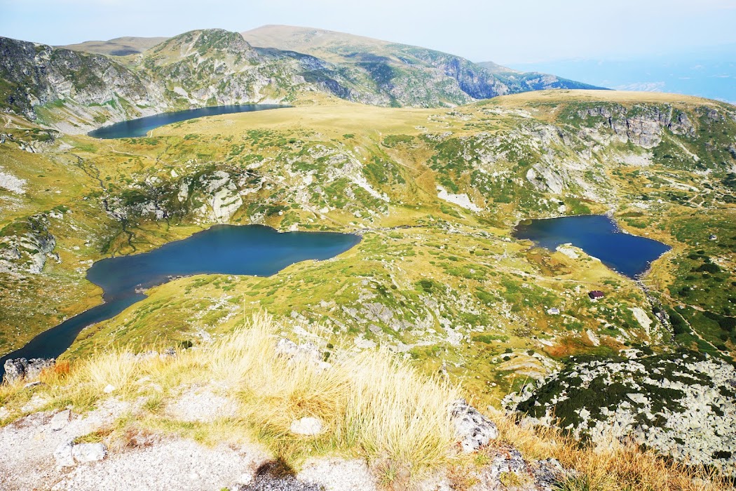
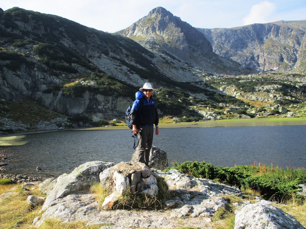
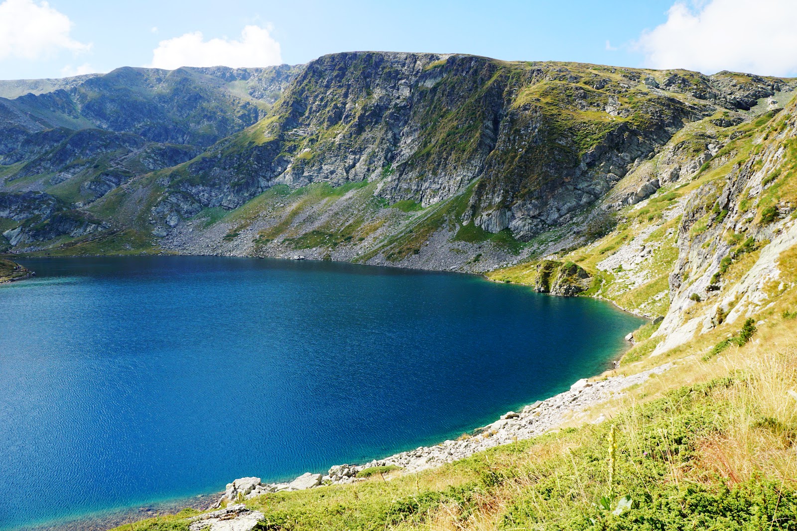
The day's target, Batizoveske Lake, reached.
Yet another waterfall on the way up, close to the lake, amongst rich vegetation.
  This was
a challenging and terrific hike. Although I miss the deserts—sounds strange—we are not going to find them on this continent. However, the greenery is overwhelming and very easy on the eye. It also allows us to remain hidden from the bears which of course, suits Jenni. I’m neutral on the matter. Before commencing a hike, a key issue is arriving at the trailhead. This means one ought to find it first. Sounds obvious but not that easy. Five years before, we undertook this hike and struggled to find the commencement point until we met a young couple who obliged when the male member pulled out his I-phone and began to click. At the time, we were close to the trailhead but did not expect it to be at the small railway station. What do we know? 

Weather worsened, for a change, once I reached the goal. On the return, spent about forty minutes in rain which turned out to be pleasant. It also meant I did not have to shower for 8 days thereafter. (8 days @ 5 minutes a session.)
  Back to the present.
On this occasion, I was on my own which in and of itself presents additional issues. Firstly, the GPS took me to the wrong place, initially. We corrected the situation, that is the system and me, after I threatened her with a withdrawal of power charges that night. I think it shocked her. Nevertheless, I expected a bit of an electrified atmosphere to develop between us but I think she chose to ignore me. Typical, just like her cousin Alexa. 

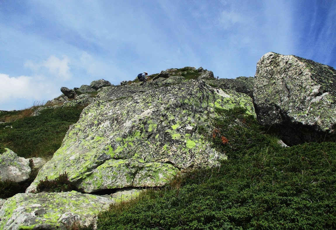
  On the rerun, I arrived at a major hospital complex. It still did not look familiar. I drove around searching for a trailhead. No success. I then headed toward the exit and as I approached, a lightbulb shone brightly in my mind. The scene was familiar. The young couple, the railway siding, hmm…and then I spotted a set of yellow trail signs. I had arrived. I turned off the light bulb and set off up a steep, rough, stony trail heading for the lake some 3,000 feet above, mostly through heavy vegetation including crossing a tricky stream. 

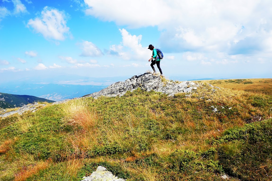
  At the time I reached the destination, I had not come across another person on the trail. This was surprising as during the summer holidays, we have found the mountains awfully busy. On the way down, difficult and tricky, no one was ahead or behind me returning although the late sleepers were heading up to the peak. By the way, the Europeans, as mentioned in the past, love the mountains and spend much time pursuing the challenges. They are a hardy bunch, mostly in good shape, who include many people our age and even older. 

In the early stages, much forest abounds.
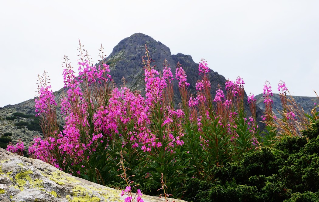
Upon breaking out of the forest, a peak became visible plus the waterflow would soon make an appearance.
  Over the years, we’ve read about terrible situations developing for climbers caught in freezing weather. On occasion, I have considered it and wondered about losing one’s limbs, ears, nose, and the ultimate, life, because of extreme cold. Yesterday, I felt it. It was a reasonable day at ground level and becoming colder at altitude. However, once I peaked at the lake and without protection from the wind, it was freezing. Good thing it’s mid-summer. 

  I took many photographs, absorbed the surroundings, grabbed a quick bite as sitting in low temperatures is not fun and headed back down. The sight of the long waterfall observed from many positions on the mountain was enough to allow me to ignore the weather for short intervals. The towns below look superb from height and I believe one of the buildings is a sanatorium. Its position at the foot of the High Tatras makes a lot of sense based upon the type of people active in the region. 

  The length of the hike is not more than 3 miles each way which emphasizes the incline. The signage which has proved to be accurate, indicates the allotted time for the upward journey at 2.5 hours. Because I wish to display the right amount of modesty, I won't mention my speed. Well, let's say if anyone objects, I won't mention it. 

"Okay, does anyone object? Anyone? Don't be shy? Okay, no objections then I suppose I'll have to announce it, reluctantly, of course: less than 2 hours." 

  The one thing worth mentioning is that I went at a steady pace and really enjoyed it, the hike, as always. Which brings me to one of the advantages of exercise (mentioned in an email recently), particularly when one pushes oneself. I find the mental peace, satisfaction and reward is beyond understanding but nevertheless, an incredible benefit as well as tremendous upliftment. While the effects will be temporary, it's renewable each time fresh effort is made.
Earlier, in the text, I mentioned the hospital below. Getting closer to the top, allows a view of it.
The telephoto does a splendid job.
Perspective: The only level and stone-free section of the trail. 8 seconds of bliss. I should have repeated it a few times.
The City of Poprad.
A view of the town of Svit from the top using the big lense.
Cheers, 

Jenni and Jeffrey