LAZAROW WORLD HIKE-ABOUT
Stunning New Zealand.
'LAZAROW WORLD HIKE-ABOUT: WHAT IN THE WORLD IS HIKE-ABOUT?'
Hike-about is an adventure that commenced June 2010. After storing our household movables, ridding ourselves of a house but retaining our 'home' together, we set off with the purpose of hiking in different parts of the world, not forgetting the home country, the USA.
Our primary focus is hiking to mountain peaks but any challenging hike will do just fine. Extended stays enable us to enjoy and experience living in various places amongst differing cultures. Hike-about has evolved into a way of life. It's also a process of discovery, both the world and ourselves.
We work and live 'on the road' but return to the city in which our grandchildren reside, every three, or slightly less, months. This provides us the wonderful opportunity to be with them as well as a child or two, even three and of course, friends.
By the end of 2025, the blog contained over 1,800 hikes (far less than actually undertaken), each a set of pictures with stories and anecdotes from the trails. An index to the right allows the viewer to identify earlier experiences.
Finally, we are often asked about the journey's end. Our reply, as accurate as we can state, is: "When we are either forced to cease through health issues or the enjoyment level no longer reaches our aspirations, we will hang up the boots."
"A Life Experience As No Other: Dare to Seize the Day Together", published by Fulton Books, depicts our life on the road and mountains until the beginning of 2017. It has developed 'exponentially' since then.
Jenni and Jeffrey Lazarow
Whereas we continue to update the blog regularly, we seldom circulate email notifications.
Thursday, September 8, 2011
6.12 Clear Creek trail and beyond--onto Mount Shasta
This is Shasta--South East approach from forest-a first view. Consider clicking on photo's to get perspective
Reputed to be the toughest part of this trail--slope ahead is a 'killer' with loose sand and rocks
Two cool ladies, over and under snow
Here we sit, in a lovely inn, in the even more lovely town of Shasta. Looking out the window, we see people coming and going as the sun winks on its way below the mountain. On the road, we meet many people from different places, eras and sometimes, from other planets, it seems. Not that we wish to judge? People say some funny things about us, too. We join in the laughter until we arrive home and then commiserate. We have spent more time at each establishment recently; we are almost semi-permanent residents as we hike in more depth at these places. It gives us the opportunity to study the hospitality industry and get a feel of what goes on in this business. Our editor says we’re too inquisitive. We just like to understand how things work and maybe suggest improvements—like an extra soft pillow for our hard head.
Coming out the forest--A "painting" of Mud Creek Canyon and falls
Facing away from the lady, looking into hazy, blue mountains
We decided that we would hike up to a certain point of Mount Shasta and get a better understanding of these 14,000 feet giants, especially the temperamental ones. We want to do it properly and besides, there is no rush—after all, our editor is still a ‘spring-chicken’. Every time we look at the lady (Shasta), we stop and compliment the Master Architect—it is a fascinating dormant volcano covered with glaciers. We often think these snow and ice covered mountains remind us of ‘killer whales’. Take another look. Anyway, we climbed a lot today, the latter part on some very rough terrain. When one gets up close, the lady’s makeup is unable to hide some of the desolation at the higher altitudes. We think, as a teenager, she suffered a terrible bout of acne.
Desolate and tough--Editor in red circle (Click pic.)
We reached an altitude of 10,000 feet, which was actually further than planned. However, it has given us confidence that we believe we can reach the summit with proper planning and an early start. For the record, we gained nearly 4,000 feet in our approach to the turn-about. The going generally was, as they say in horseracing parlance, ‘good’. However, the last half-mile or so was rough, slippery and dangerous. Once we passed that section however, it became only strenuous. Our guidebook states it's the toughest section of the whole climb. That is indeed a confidence booster. The mountain face that's not covered in snow and ice is barren and desolate. Yet it is attractive reminding us of a less colorful Haleakala Crater on Maui.
On the edge of a glacier (Watkins Glacier, we think)
Our closest view of the peaks
A moon scene, perhaps?
It is difficult to explain the feeling of being so high up, on a fascinating mountain surrounded by glaciers, streams, waterfalls and snow patches while looking into the tree-filled valleys and the distant blue-mountains. A person feels fortunate to be alive—to have the energy, strength and health to be in that position. A little later, nearing completion of nine miles, the same person is tired and sore and can’t wait to get off the ‘bloody’ mountain.
And now clouds appear on the scene
In a country of many millions of people and thousands of cities, what is the chance of meeting two men on Mount Shasta at 9,400 feet on a Wednesday, the only two people seen all day and they happen to be from San Diego—all four of us from the same place. The only difference is they have ‘funny accents’. It’s about time people like Bill and Carl learned to speak properly.
Bill, Carl and um...Hey, Guys, does this look like a pimple developing?
Cheers,
Jenni and 'Shamu'
Touchdown Chargers
Editor looks like she needs 'a little help from her friends'. Mud Creek Canyon and forests below
On the way home--it's been quite a day
Tuesday, September 6, 2011
6.11 Black Butte, Shasta-Trinity National Forest
Black Butte as seen from the town (red dot is destination)
Mount Shasta from the town
Front row seating for the Editor
Feeling a little on edge with Shasta watching
The eyes blinked, opened wide again and then stared. The heart fluttered and the temperature rose quickly before settling a little lower. It felt like an icicle forming along the spine but in this heat, it surely wasn’t. Nevertheless, we shivered slightly. We gazed in amazement, mesmerized by such an incredible sight. Often, our editor has that effect over us. However, today the cause of this reaction in mind and body was from a different source. As we rounded a long, slow bend on the freeway, glorious Mount Shasta appeared. Like its ‘buddies’ , Hood and Rainier further north, it is more than just a landmark.
Some eleven years ago, we traveled with Gavin to Seattle where he served an internship. When we caught a glimpse of this majestic glacier-part-covered-mountain en route, we knew that one day we would return. Last October we hiked a couple of miles up as we only had allowed for an afternoon in Shasta. So now, we find ourselves in this magnificent region without any excuses unless we become more creative.
Rocky trail might just be an accurate statement
Then again, maybe it's a quarry
We were puzzled when our editor mentioned black beauty as a climb for today. We don’t get into issues of color and controversial topics. “I can’t help it if you can’t spell,” she informed us. “Black Butte, silly; and don’t go thinking I’m talking about your anatomy even though I find it very cute.” We must be honest—the last part we made up. Sometimes we are desperate. When we first looked at the stiff peak, we thought our editor was joking. "We don't see a way up to the top," we exclaimed. Of course, our protest was half-hearted. We were raring to get going.
The 'beauty' from Black Butte Peak
Today’s hike was superb or even better. We find ourselves in an exquisite part of the world. There are places that a person just knows will be exceptional—this is one of them. The hike, rated strenuous and attractive, requires rock stepping for about two miles. One needs tough soles and continuous concentration as each step is critical. There are views of Shasta for much of the trail, which makes for visual delights.
I forgot about the return. Silly me.
The first 'miracle' of the day is that we arrived at the trailhead with only one misstep. For a couple who consider getting out the car park on a first attempt as success, this was a good start. The trailhead, or what appeared to be the commencement point, was deserted and so was the hike. In our five hours, including the drive on the forest roads and time spent on the trail, we never came across another person. We are beginning to think the problem is not the trails but perhaps, our editor. Of course, it could not be her husband.
A rock slide? Now you tell me. I thought the rangers bonded these rocks safely.
Mount Shasta is spectacular. No doubt, we will mention more about our visit in the next few days as we prepare to climb her. We hope that she treats us well as we come with an abundance of respect and humility for this looming and dangerous edifice.
Cheers,
Jenni and Jeffrey
From our peak to the "big boys'" peak--maybe a partial attempt tomorrow
Working on some balancing techniques, poise will come later, hopefully.
Enough sunbathing. The last push is ahead.
Monday, September 5, 2011
Hike 6.10 East Peak—Mount Tamalpais, Marin County
"We've looked at clouds from both sides now"
Jenni at half-way stage, gazing at peak.
Above it all, a bit of paradise. Note the forming of the mountain tops in clouds at bottom left
Head in the clouds
We notice that to the locals it’s Mount Tam. Of course, we know our place. Until a person is a resident of the county, it is the correct etiquette to use the formal name—Mount Tamalpais. We won’t act too familiar although we love climbing, crawling and hiking all over this interesting specimen. One can say much about San Francisco (if one would like to) but you have to give it high marks for an affinity with the natural beauty.
The cyclists are very active in the area and it would not come as a surprise to be knocked down by one or, even more than one. We are now on full alert for bears, mountain lions, snakes, coyotes, cyclists and directions. We admit there is never a dull moment on the trails. In fact, sometimes, like now, we sit and arrange pictures and become very emotionally charged. There is no doubt this lifestyle is most suitable and we feel blessed. B’H.
Bays, bridges, boulders, height and clouds make one boy very happy
Jenni enjoying her share of boulders at the peak
We notice the style in this part of the world is to have multiple trails, many intersecting here, there and everywhere. Today, we hiked a yard or two under nine miles with an elevation gain of only 1,200 feet, arriving at the east peak of nearly 2,800 feet. It was not much of a sweat but it was spectacular. Climbing and sitting on rocks at the peak filled us with a feeling of tranquility and peace. It was outstanding; one which we think will remain with us for a while. Half-way up the mountain, we stopped at an ‘inn’ for tea and coffee. It is an upscale bunkhouse with cabins but no services—bring your own sheets, food and hot water. It is an interesting concept. Jen suggested an idea of a getaway for a family who happen to enjoy the outdoors and outhouses.
Sausalito Bay-top left
Bon Tempe Lake--our Friday hike has a picture taken from the valley on the other side of Mt Tamalpais with the lake in the foreground--the opposite position.
Looking down into the valley
On Friday, we mentioned our issue of being slightly off-course. Okay, lost. We related how we always feel the need to pay tribute to David and of course, now Barry to a degree. It is difficult to mention this without coming across in the wrong way. Nevertheless, here goes. We completed the hike and walked by three youngsters, two women and a man, overhearing one of them mention to her mom on the phone that they were unable to get back to their car, some six miles away. Immediately, we thought how fortunate we are to be presented with an opportunity to do a ‘David’. Wow! Clearly, Joy, Jennifer and Sergio could not understand why we were so grateful to them, arguably, the highlight of our day.
Cheers,
Jenni and Jeffrey
It really was a spectacular day
Jenni peaks--hard not to be excited
Notice pylon protruding through clouds (Maybe Golden Gate?)
Saturday, September 3, 2011
6.08 and 6.09 Lost and found and oops, lost again...(ach shame)
6.09 Carson Falls, Tamalpais State Park-Friday;
and various trails in both parks.
Lake Bon Tempe and Mount Tamalpais
Maude and Theo Alge of Boston, whom we have known for more than fifty years, asked us a question the day prior to hike 6.09 about following trails and getting lost. We gave our answer and on the hike following the question, we lost ourselves. Actually, that’s not true. We were never lost—the trail, we think, was lost to us. The last time we were in a similar position, an angel arrived ‘out of the blue’ and gave us a ride to our car parked some twenty miles away. We never forget the kindness shown to us by David of Durango, Colorado. He was the first person we’d come across in six hours on that mountain. The kindness of strangers is awesome and most humbling—people helping people without any thought or expectation of reciprocation.
Expert trail spotter searching for trees. Not an easy task
Ranger Barry to rescue (2011)
Mensch David of Durango to rescue (2009)
Today’s circumstances were a little different but they had an extra complication being pre-Shabbos, something that worries us enormously. We are currently moving about San Raphael and the neighboring towns. Yesterday, we had a lengthy hike up, down and around China Camp State Park (11 miles) situate alongside San Pedro Bay with views of various bridges of the greater San Francisco region. Today, we set out for a seven-mile hike, which ended (fortunately), at over ten and ‘change’. We tried to put on a brave face for our dear editor so she would not be concerned. After all, we must always act as the big, brave and of course, humble spouse. We are most grateful though that she brought extra tissues to dry our wet eyes and wipe our ‘runny’ nose every few minutes. She really helps us in achieving our courage.
Editor showing her 'sticky' boots in action
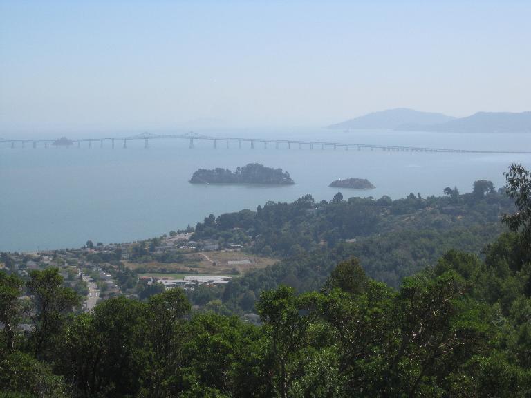
Richmond-San Raphael Bay Bridge from Patrick's Peak. On a clear day, besides seeing forever, another four bridges can be viewed.
The initial part of the hike took us to the peak of the first mountain and thereafter, down to the waterfall. We forgot to ask if they turn on the ‘falls’ at the end of summer. Just like Mother Hubbard’s dilemma, the falls were fine but there was an absence of water. We continued through the forest and spotted some Redwoods. Well, it hardly takes a genius to notice a giant tree that looks like it reaches to the sky. On and on we trudged while carefully following the trail and our editor’s notes. We were due to make a left turn after two miles from the falls but apparently, between the two of us, we had difficulty deciding our right from left and so went straight instead.
Couple of big 'uns--Redwoods
Scene of tranquility after hectic day
After a quick hour’s walk along the ‘fire road’, we got our always-welcome pre-Shabbos call from Gavin. Having telephone reception out in the wild is quite unusual. “Send the helicopter for us”, our editor requested. Gav, of course, of logical mind wanted to know when the family had purchased a ‘whirly bird’. Maybe if we spent less time in the wilds we could afford one. Then again, we wouldn’t get lost in the city so who needs a helicopter. After nearly four hours on the trail, we had not seen another human. “Hashem, we need David again.”
We tend to resist turning around because the solution might be looming just beyond the next bend so we continued. Some of the things we were seeing made sense—the sun, the sky, the trees, water—these were all familiar to us. About three miles from where the ‘Old Vee Road’ should have been, we came across a “V” in the road and took the left fork. We strode up the short, sharp incline and found ourselves on a damn…um… a dam wall, next to Alpine Lake but still not a soul about. The problem was that once we had missed our reference point, we were unsure of where this road or any other would lead. Besides, according to our ‘accurate notes’, a lake should not have been in this position.
Taking a reading from the sun's position--seems like we got it wrong
‘What’s that sound?’ We turned to see Ranger Barry in his pick-up truck careening down the hill. After indicating to him to stop, we explained our difficulty which of course was that someone had signposted the trail incorrectly or hidden the “V”. Barry, without hesitation, dropped us at our car, which was only five miles away. However, having no idea of our position made the situation difficult.
After offering our gratitude and feeling somewhat embarrassed, we decided to complete a hike to Bon Tempe Lake if only to see whether we could still do it. Guess what. On our return, we lost the trail again.
Maude and Theo: Please. No more difficult questions.
China Camp--Gap in trees show steep decline we 'rolled down'
We remember the days when we feared our parents would find out that we had got ourselves into trouble. These days we don't want our children to know. Finally, we always like to learn from our mistakes. Today's lesson: Ensure that we carry extra tissues.
Maybe we should make a comeback to golf
Cheers,
Mutt and Jen
Friday, September 2, 2011
6.07 Snivley Summit and Pinyon Peak, Garland Ranch Park
Editor struggling in the rough--feeling somewhat less smug
Editor at peak pointing to where she would like to throw me (Click to enlarge to see trail)
Tuesday
It’s difficult to describe the feeling of today’s outing. It followed upon two unique experiences so it had to offer much if it was to maintain the trend. It sure did. We crossed changing terrain as we climbed—did we mention climb—had wonderful views into the valley and across at the neighboring mountains as well as a distant peep at Monterey Bay. We don’t particularly like the phrase used to categorize the hike but it provides an accurate summation—a ‘butt-kicker’. The trail has two very steep components to follow to reach the summit. Thereafter, a free climbing/scrambling extremely steep section on the edge of the mountain tests the nerves and the muscles again. At this second peak, with well over 2,000 feet elevation gain, sits a fire tower, not an official part of the hike.
The last push, the peak above the peak--tower just showing (Click to enlarge)
Our editor, again showing courage and determination, sets a wonderful precedent for us as we struggle on the slippery slopes. On the way down, for about a mile, we decided to jog. It was reminiscent of our army days. We decided to be a drill-sergeant. Besides acting like a cruel and heartless bully, we enjoyed shouting out commands to our editor (for a change). The fun part was using the same name ‘LUZZA-bloody-ROW’ as our sergeant had some forty years ago. Of course, our language was quite refined. To think that our editor enjoys all this makes us wonder. Although we had the 7.5 miles trail to ourselves, we do hope nobody was around observing our silliness. Off the record, we think she enjoyed it.
From Snivley Summit, pointing towards Pinyon Peak
Volunteers maintain the Garland Ranch Park wonderfully. Strange that things can be done well without tax ‘hikes’. By the way, the Park is along Carmel Creek Road, a road we once lived off some years ago when we had a home. For the record, that road is in San Diego, not Carmel. Golfers will know of the famed course, Pebble Beach, close-by. Following a hike, we usually find that we don’t have that much energy for a round of golf no matter how interesting the links.
A view into the valley from half-way up
It’s time to leave Monterey and head north again. Remember when they said: “Go west, young man”. How the times are changing. We’re neither young nor going in the right direction.
"I think we're lost. I can't see where we go from here. Can't even see the editor" (Ocean to the left)
Cheers,
Jenni and Jeffrey