A burst of color before summer

Chased this little fella or his/her cousin, friend, sister, brother all over the trails. (The blurred trees are about 2,000 feet below the bird)

One of the many peaks spread around the park, approaching the saddle
We are beginning to miss water. After seeing some of the finest bodies of blue water last autumn, with reflections of fall colors lighting up our lives, or swimming in freezing water at 11,000 feet above sea level in summer, it is understandable we have this feeling. For the colors, we’ll have to wait but hopefully, the water should be available as we try and head northwards.
We left reasonably early this morning for our second visit to the park, using an entrance miles from yesterday’s. Our health has improved, the weather is definitely summery, our propensity for work is low, our energy level is high although our fitness needs improvement. Today, we were supposed to hike 8.1 miles with more than 1,600 feet elevation gain in what is classified as a strenuous and beautiful experience. By the time we reached Deer Flats, neither of the two parameters seemed applicable. We decided to push on towards the summit. We estimate a cumulative elevation gain of over 2,500 feet after the additions, for the hike. Looking towards Jenni, now lying comfortably on her bed with the occasional mumble about sore feet and tired muscles, the gain and pain might have been a lot more.

'Looks like going left or right is easier than up', the expression seems to read.

Jenni coming down fast and through a 'tight' section.
We located a defined path and added a further 2.5 miles onto some of the high points which included lovely views and colorful plant and bird life. The walks along the ridges provided unhindered vistas in the distance while the paths were steep and extremely slippery in places. We find that it is not a good idea to stop on the way up as when restarting, one gets into the equivalent of a 'wheel-spin'. On the way down, the danger level is high because, continuing with the same analogy, one becomes like a runaway truck. It can be tricky especially finding oneself on the butt in a flash.

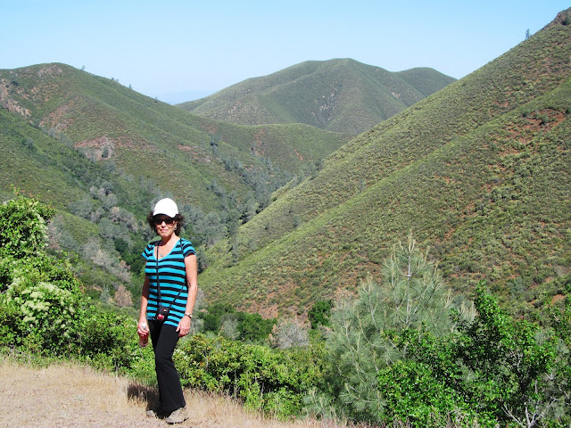
Jen stands above Mitchell Canyon early in the hike. Later we went down and through it; guess what? We got lost

Oops!
We had good directions but became confused at one point on our return where there were two paths close to each other. It requires only one mistake or misunderstanding to blow it. Once again, we took the opportunity and blew it. We continued down into the canyon via another steep, narrow and slippery trail for 2.6 miles finding ourselves at a different park entrance. We had been reviewing our trail instructions but to no avail. Having walked 10.5 miles by that stage, we were now back at ground level. By the way, the first person we’d seen anywhere near the mountain was an hour earlier. For the rest, the place seemed deserted.

A stripped mountain face above a quarry (right rear); one of the San Francisco bays in the distance

Cautious move down (sideways) as we came across very steep trails

I should be working? Of course, I'm working...on my table manners. Our first stop at Deer Flats (3.7 miles) after a bit of a climb
Out of the blue, strode a distinguished gentleman who for purposes of this narrative, we’ll call Jeff. Jenni nudged us to make inquiries. It was just in the last blog in which we wrote of the kindness of strangers, the most touching of generosity. We understand one of the reasons such kindness is so special is because it is done without expectation of reciprocity. Long story short. When Jeff mentioned that our trailhead was two miles away, we could deal with it. However, he added a rider. ‘Some people have calculated it being closer to four miles’. After having completed a fairly tough hike, another four miles sounded like a bad idea.
We are most grateful to Jeffrey Glassauer (Jeff) for depositing us safely next to our car after enjoying good conversation, too. Thank you again, Jeff.
Cheers,
Jenni and Jeffrey

Our opening line mentioned the need for water. Can you guess where we found this lake just before sunset the
following day? A clue is the picture below.

Sunset at Redding, 'beauties' over a hundred miles distant
No comments:
Post a Comment